Images from my first day in the new job!
Launch site Lees Ferry at dawn, looking towards the Paria riffle west towards Marble Canyon. You can just about see a USGS cableway used for sampling the river stage (height), discharge, and sediment:
Lees Ferry is the only place where you can drive to the waters edge in the whole of the Colorado River in canyon country, therefore it is used to launch craft looking to go upriver (east through Glen Canyon towards Glen Canyon Dam), or downriver through Marble Canyon and Grand Canyon. It is so-called because it was once the site of a ferry which allowed people to cross the Colorado, named after a Mormon settler John Lee.
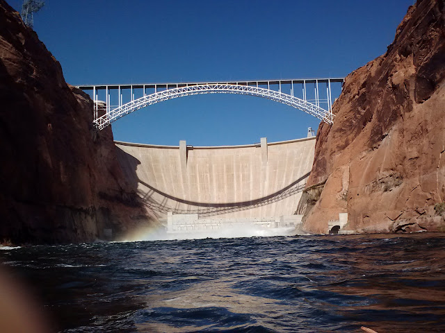
We went upstream in a small rib (inflatable boat) towards Glen Canyon Dam (picture below is as close as we dare to get!) during a high flow experiment:
The high flow experiment (controlled flood) is designed to build sandbars. Since the construction of the dam in 1963 the sandbars (beaches at the river edge) in Glen, Marble and Grand Canyons have undergone massive erosion. Halting this trend is a key goal for a number of reasons: for example, sandbars provide habitat, shelter and spawning ground for fish, and also sites for campers rafting or canoeing downstream.
Our task was to surveying the water level during this controlled flood where the water level is much higher than normal, in order to update and expand the stage-(dam)discharge relationship. These controlled floods only come about every 4 years so it's a rare and exciting opportunity to do so.
View of one of the larger sandbars at one of the important archaeological sites (you can just about make out my colleagues if you click on the image to expand it):
Anyway, a really really brief tiny taste of what I do now, for anyone who was wondering!


Not a bad day at the office, it might not be the coast but its pretty impressive! Happy Days...
ReplyDelete